The Global Water Initiative has supported Dr. Salvi Asefi for much of this year to do research on water and climate change. Dr. Asefi was a member of Professor Deborah Lawrence’s climate change research team. She has studied Lake Tanganyika watershed in East Africa, and its future water availability as the climate changes. We spoke with her.
1. You have studied the Lake Tanganyika watershed in East Africa, and its future water availability as the climate changes. Why is Lake Tanganyika an important lake to study in the context of East Africa, and are there particular features that are very specific to this lake?
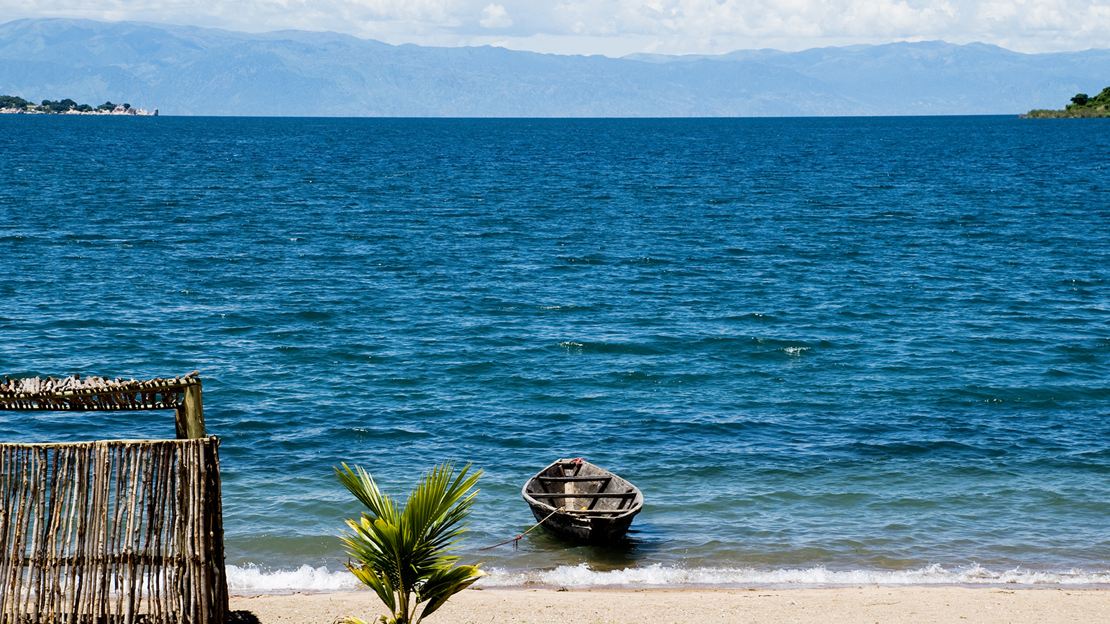
Lake Tanganyika Basin is a part of Congo-Zaire drainage basin, which includes Lake Tanganyika. Considered one of the healthiest and most ecologically intact lake systems in the world and a globally significant biodiversity hotspot, Lake Tanganyika is home to more than 250 fish species found nowhere else on Earth and over 90% of Tanzania’s endangered chimpanzees are in forested mountains on the lake’s eastern shore. The lake holds approximately 17% of the world’s surface freshwater resources and is the second deepest and largest by volume fresh water lake in the world. It is estimated that more than 12 million people call the basin home across the four countries of Burundi, Democratic Republic of Congo, Tanzania, and Zambia. The lake and surrounding basin face serious environmental threats including sedimentation and erosion due to unsustainable agricultural practices and deforestation, excessive discharge of industrial and urban pollution into the lake, increasing human population, and overexploitation of the lake’s fish stock.
Our motivation for this study was two-fold. First, we pursued this work as part of our East Africa project objectives to study the impacts of climate change on Africa’s Great Lakes and to use this knowledge to inform conservation planning in the region. In addition, we were collaborating with The Nature Conservancy (TNC) to contribute information on climate change to the Lake Tanganyika Freshwater Atlas. The Lake Tanganyika Fresh Water Atlas is a decision support tool generated by TNC that organizes over 700 spatial datasets to provide the Lake Tanganyika Authority (http://lta.iwlearn.org/) and other local decision makers and managers with efficient access to high-quality information for planning and includes data on both the biophysical and social aspects of the basin.
2. In your work with Dr. Tracy Baker from The Nature Conservancy, you look at the impact of climate change on the Lake. What are some of the preliminary findings of your research?
We studied the impacts of climate change on the long-term water balance of the Lake Tanganyika Basin. We did this using the SWAT (Soil and Water Assessment Tool; https://swat.tamu.edu/) model for two different climate change scenarios (RCP 4.5 and RCP 8.5) from 1979 to 2100. The resulting outputs for stream discharge, suspended sediment, and soil yield from these model runs are being incorporated into the Lake Tanganyika Fresh Water Atlas, but we focused our final more in-depth analysis on the worst-case climate change scenario (referred to as RCP8.5). We found the extreme case particularly informative because it reveals numerous water security risks potentially facing the basin.
The worst-case climate change scenario assumes a world where population is high and income growth is relatively slow while rates of technological change and energy improvements are modest. In addition, under this scenario, no climate change policies are in place and there is a high demand for energy causing greenhouse gas emissions to rapidly rise resulting in severe climate change impacts around the world. In this scenario, global temperature is projected to increase by 2 °C by mid century.
For this study, we quantified several measures for freshwater availability including surface water, ground water and water storage applied for agricultural purposes.
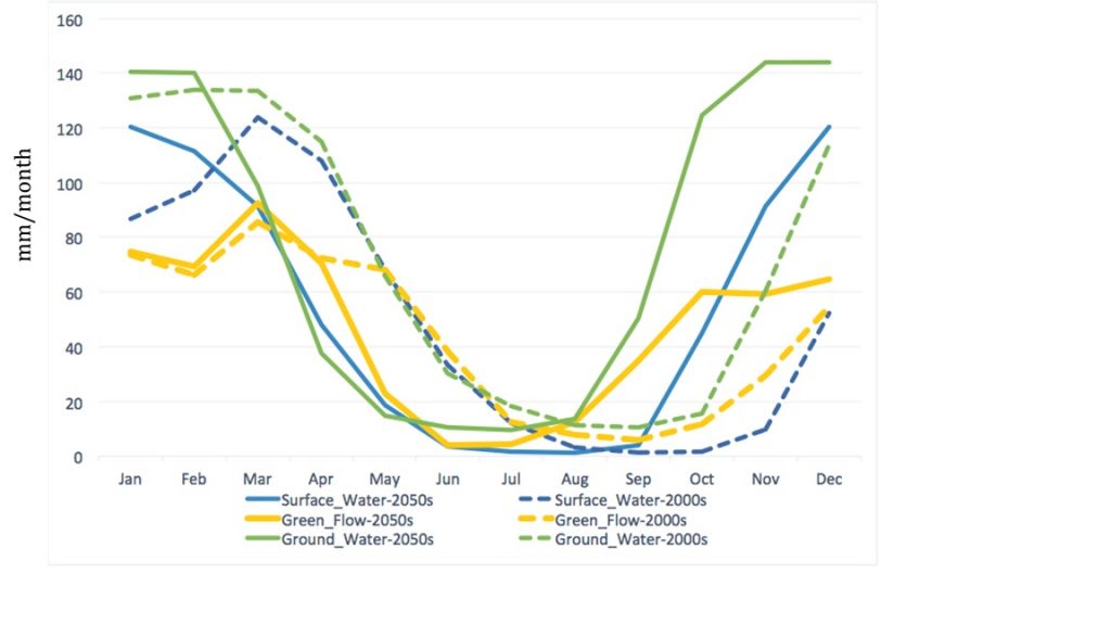
Preliminary results show that on the one hand, the annual freshwater availability in the basin is projected to increase by 2050 only by a small amount despite large increases in the annual precipitation. Runoff is also projected to increase modestly across the entire basin while sedimentation is projected to increase more dramatically.
More dramatic change appears to be a result of the seasonal pattern of the freshwater availability, which is expected to shift about 3 to 4 months by mid-century (FIGURE). This shift may have significant impacts on human activities particularly in agriculture.
Combining our projections with those of population growth, we find that the number of people experiencing water scarcity within the basin could double by 2050.
3. To construct a hydrological model for Lake Tanganyika Basin, what were some of the main challenges that you faced, and what will you be working on next to finalize the project?
A major challenge we faced was the lack of stream discharge data and accurate weather information. We need such observational datasets to parameterize, calibrate, and then validate the model. Due to the poor quality of some of our datasets, we relied on scientific methods suggested for use in predicting rainfall-runoff responses in ungauged or poorly gauged basins. We are still finalizing this aspect of the study and intend to incorporate satellite observations and also bias-correct some of our uncertain datasets. The resulting analysis will then be published in a peer-reviewed publication.
Despite some of the abovementioned uncertainties we believe our study will contribute meaningfully to planning efforts in the basin. For hydrological modeling of the Lake Tanganyika Basin, we selected the SWAT model because it was specifically designed for use in large data poor basins and facilitates a big picture focus on understanding the relative magnitude and direction of change under factors such as climate or improved land management decisions.
As part of the Lake Tanganyika Fresh Water Atlas, our results will be useful for decision makers in water and land use management and planning and allow them to begin planning activities to mitigate the potential negative consequences of climate change on fisheries in the lake and the communities who rely on them.
To see this work as part of the Lake Tanganyika Freshwater Atlas, please feel free to download the spatial data and ArcReader application here.
Dr Salvi Asefi-Najafabady received her PhD in Atmospheric Science from the University of Alabama (Huntsville) in 2009. In recent years the focus of her research has been on climate change impact analysis.